top of page

fliteEYES Aerial Photography & Virtual Tours
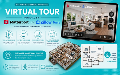
Elevate your property through aerial photography, 3D virtual tours, floor plans, and aerial 360° panoramas.
Located in New York's Hudson Valley, we provide Aerial Imaging and 3D Virtual Tour services to most of Columbia, Dutchess, Ulster, Orange and Westchester counties, as well as western Connecticut.


Safety First
FAA licensed and all flights are conducted with adherence to FAA 'Part 107' regulations.
Client Focus
We work with and listen to our clients to ensure the final product meets their goals.
Innovation
By utilizing high quality equipment and innovative techniques we can deliver quality content.
bottom of page